Aeronautical Data Aggregation and Field Estimation in IoT Networks: Hovering and Traveling Time Dilemma of UAVs
Overview
The Internet of things (IoT) advancement relies on connecting a huge number of sensors that are inexpensive, simple structured and self-powered.
IoT network offers a solution to avoid and manage natural disasters (such as forest fire, floods, etc.).
Objective is to collect data from IoT devices that are spread over an area of interest while considering network constraints (for instance, IoT devices are low cost, simple structured and self-powered).
Traditional Data Aggregation Methods
- Direct transmission suffers from high power consumption.
- Relaying suffers from data routing complexity.
Proposed Data Aggregation Method
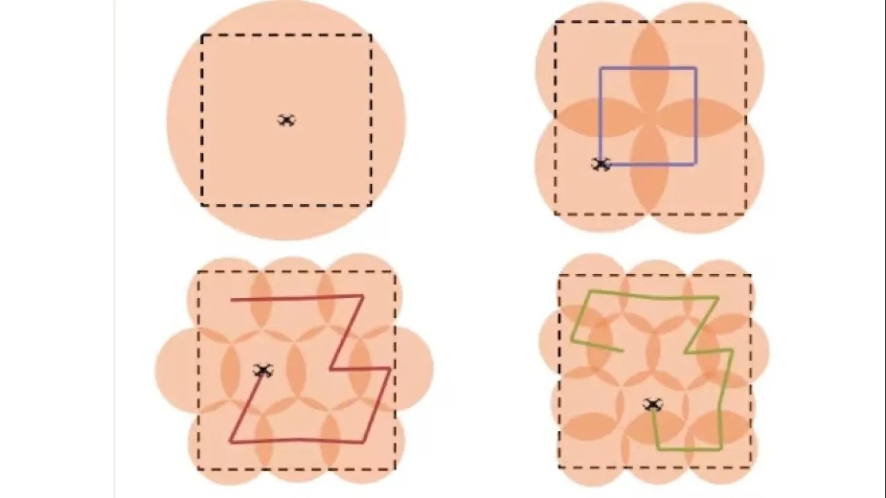
The UAV hovers over M hovering locations (HLs) where it sends wake up signal to close sensors within its hovering area. Sensors transmit using slotted ALOHA.
While reducing sensors transmission power consumption and simplifying network routing, the use of UAV introduces an extra traveling delay.
Problem Formulation
Find the optimum number of Hovering circles (M), their radiuses (R) and locations (L) to minimize the total mission time, provided that,
- average number of observations collected is not less than (y)
- The whole area is covered
Total mission time is equal to the summation of traveling time and hovering time. While high number of hovering locations (M) reduces the hovering time (since smaller coverage regions and higher SINR channels are obtained), a higher traveling time is needed to visit all the HLs as shown in the Figure:
Results